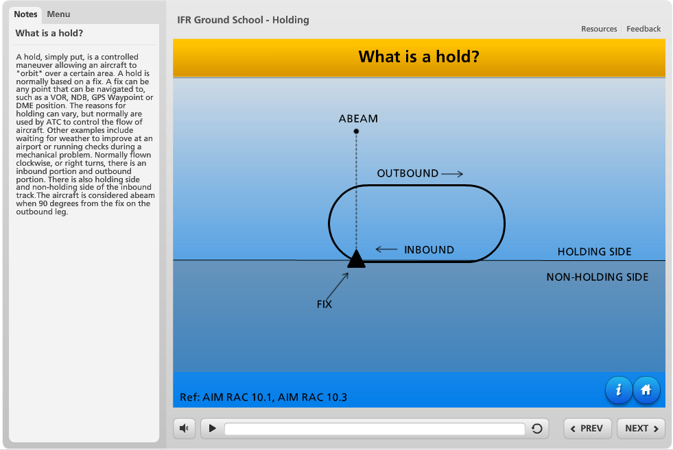
ILS Approaches Explained (for non-pilots)
ILS stands for instrument landing system. ILS is the most widely used and accurate system for aircraft to approach airports with low visibility and/or cloud ceiling.
The most common type of ILS is category 1 (CAT I) , that is typically used to bring aircraft to about 200 feet above the ground. Local geographic restrictions may prevent an ILS from bringing aircraft as low as 200 feet. Less common are category 2 and category 3 approaches that bring aircraft down to 100 feet and 50 feet respectively.
In Canada, any pilot with an instrument flight rule rating can fly a certified IFR aircraft on a CAT I approach, while specific training, certification and additional aircraft equipment are required for CAT II and CAT III approaches.
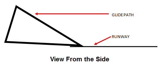
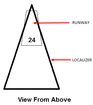
Regardless of the type of ILS approach, its concept remains the same. Ground based equipment sends out two radio beams. One beam provides guidance left and right (localizer) while other beam provided guidance up and down (glide path).
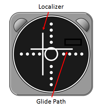
In the flight deck pilots typically see two needles representing the glide path and localizer. The middle of the instrument represents the aircraft. If the glide path needle is moving up, it means the aircraft is below the glide path, and the pilot should slow the descent to get back on the glide path. The same is for the localizer needle. If the needle moves left it means the aircraft is right of the path. As the aircraft gets closer to the runway, the glide path and localizer get more sensitive. Only small changes by the pilot are necessary to stay on the localizer and glide path.
Every ILS has a decision height. The aircraft will continue along the localizer and glide path until the decision height. If the pilots cannot see the runway, they must execute a go-around. A go-around, also known as a missed approach, is when the pilots stop the approach and climb away from the ground.
Even thought the ILS is the most widely used and accurate instrument approach, it is also expensive to install and maintain. Only airports with enough traffic and bad weather days will invest in these systems.